
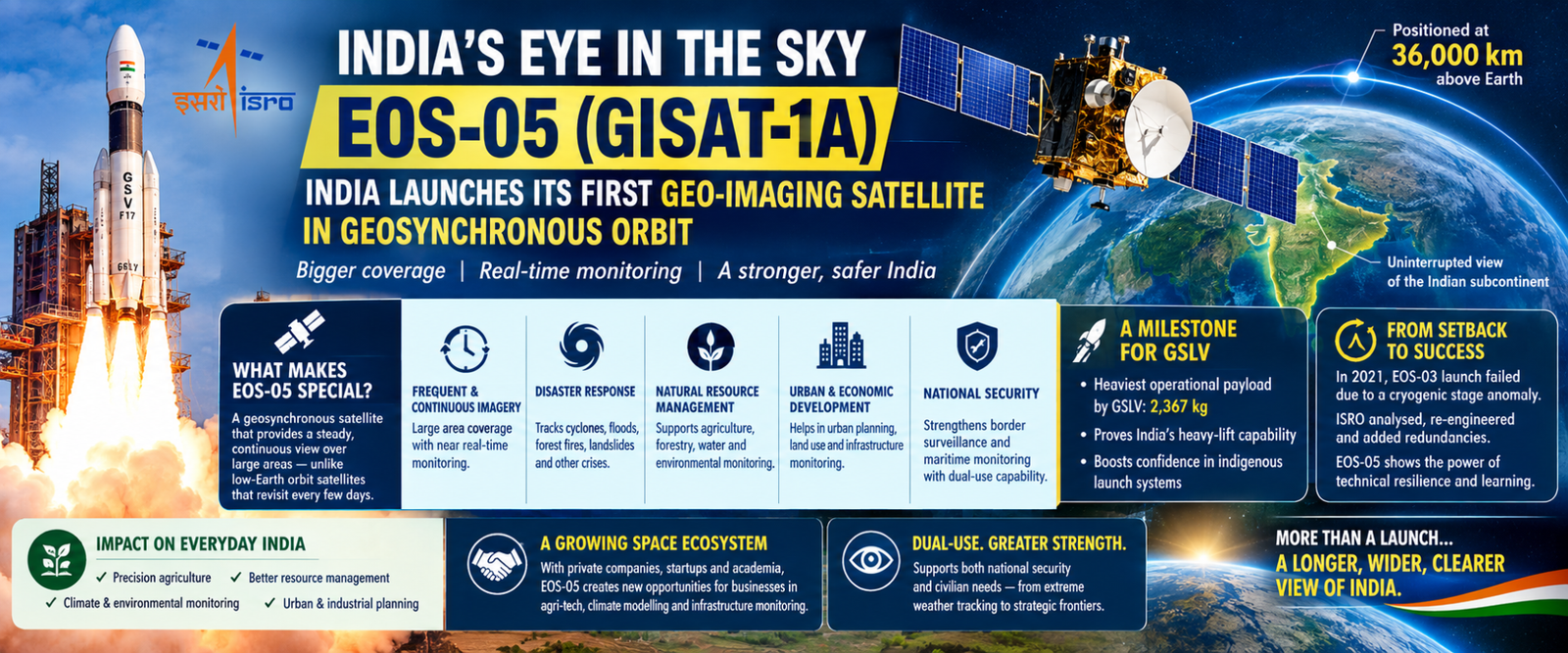
A few days back, on Sept 4, 2026, India gained a new eye in the sky as it successfully launched EOS-05, also known as GISAT-1A, the country’s first dedicated geo-imaging satellite designed to operate from a geosynchronous orbit.
Positioned aboard ISRO’s GSLV-F17 rocket from Sriharikota, the mission marks a crucial technological milestone that fundamentally expands India’s capacity to monitor large areas of its territory at frequent, near-continuous intervals.
The true significance of EOS-05 lies in the specialized orbital location it is designed to occupy. Unlike conventional Earth-observation satellites that travel around the planet in lower orbits and periodically revisit a particular location every few days, a geosynchronous satellite maintains a persistent, steady view over a broad geographical region.
Positioned approximately 36,000 kilometres above the Earth, EOS-05 provides an uninterrupted vantage point directly over the Indian subcontinent.
Adding a new dimension in earth observation, Satellite imagery has long been a foundational tool for modern governance, supporting agriculture, forest management, water resources, urban expansion, and disaster response.
EOS-05 adds an essential capability to India’s existing Earth-observation constellation by operating from a high-altitude vantage point. During a cyclone, frequent imagery enables authorities to track its atmospheric development, wind speed, and landfall path. During severe flooding, repeated observations help identify the spread of inundation and isolate affected areas. Similar real-time applications apply to tracking forest fires, landslides, and other rapidly evolving regional crises.
A Milestone for the GSLV, the mission also represents a significant achievement for India’s launch-vehicle program. Weighing approximately 2,367 kg, EOS-05, stands as the heaviest operational payload launched by the GSLV architecture to date. Its successful deployment demonstrates the growing maturity of India’s capability to deliver heavy spacecraft into high-altitude transfer orbits. While the reliable PSLV serves as the backbone for low-Earth orbit missions, the GSLV provides the heavy-lift capacity essential for geosynchronous operations. The success of GSLV-F17 strengthens national confidence in an indigenous launch system capable of supporting increasingly complex spacecraft and future high-value missions.
The success was not easy. It turned a setback into capability. EOS-05 also represents the successful recovery of a mission concept that faced a severe technical setback in the past. In August 2021, ISRO’s attempt to launch EOS-03—the earlier iteration of the geo-imaging concept—aboard GSLV-F10 ended unsuccessfully due to an anomaly in the cryogenic upper stage. The setback underscored the engineering complexities involved in sending heavy Earth-observation satellites into geosynchronous orbit. The intervening years provided ISRO engineers with the opportunity to conduct thorough failure analyses, re-engineer flight systems, and incorporate critical redundancies. The successful flight of EOS-05 highlights the vital role of technical resilience and learning within an ambitious space program.
Beyond emergency Disaster Response scenarios, EOS-05 supports precision agriculture, forestry, water management, and environmental monitoring. Satellite data assists farmers by tracking crop health, assessing land use, and gauging climate impacts. Furthermore, as Indian cities and industrial corridors expand, regularly updated imagery offers urban planners a comprehensive picture of changing landscapes, illustrating how space technology serves as an active instrument of national development.
EOS-05 adds a powerful layer to India’s broader space-based situational awareness. Continuous surveillance over remote border zones and maritime regions complements existing low-Earth orbit satellites. Importantly, the strength of India’s space program lies in developing dual-use assets that simultaneously address national security needs and essential civilian priorities, from tracking extreme weather to monitoring strategic frontiers.
The mission arrives as India’s space sector expands to include private companies, startups, and academic institutions. High-frequency Earth-observation data unlocks new opportunities for commercial enterprises to build specialized tools for precision farming, climate risk modelling, and infrastructure monitoring, aligning with a broader national effort to integrate space-based data directly into economic growth.
While the launch of EOS-05 is a historic milestone, its ultimate success depends on how effectively its raw data is converted into actionable decisions on the ground. For India, this means faster emergency response, improved resource management, and more informed agricultural planning. EOS-05 adds a vital persistent dimension to India’s space architecture, ensuring the country’s view from space remains wide, continuous, and practical.

